Inspired by an environmental disaster nearly two decades ago, a comprehensive new research project is underway at the Skidaway Institute that could change our understanding of how pollutants interact with marshes.
Backed by two national research labs, and lead by two local scientists, the multi–faceted project will create the most accurate topographical map of the Grove Creek marsh ever made, and then test a hypothetical model designed to better understand how water, particularly polluted water, travels through the marsh.
The results of the study could affect everything from waste water permitting to flood plain mapping and storm surge inundation models.
In 1991, the nuclear facility at the Savannah River Site accidentally released tritium, a radioactive isotope of hydrogen, into the Savannah River. The scientific and environmental communities leapt into action to follow the polluted water as it made its way downstream.
“There was an enormous effort to collect data along the Georgia coast and even South Carolina. The cloud was traced all the way to Florida,” says Dr. Jack Blanton, a researcher at the Skidaway Institute.
What they discovered by watching the tritium was that the prevailing wisdom regarding how water flowed through marsh needed to be reconsidered.
“What we found out is that some of that Tritium was locked up in some of the marshy areas,” Blanton explains. “The tide wouldn’t put it in the marsh and then flush it back out. It would stay in those grassy areas.”
Although they had some evidence demonstrating the new understanding of the marsh, it would take scientists more than 15 years to return with a model for how the marsh worked.
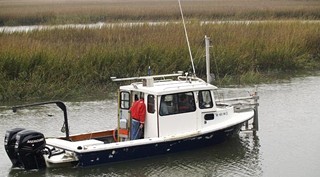
In 2007, Blanton conducted a pilot study in the marsh to more thoroughly investigate. He dumped a slug of non–hazardous dye into the creek and then monitored it as it moved through the marsh, using sensors to detect the concentrations of the dye.
Again, he found that, although the tide carried water in and out of the marsh, not all of the dye was carried out by the tide.
“The creek will flush a lot of that out, but there’s enough retained in the marsh, that it takes several days to get the dye down to concentrations you can barely measure,” says Blanton.
Although the field study demonstrated the same effect, the mathematical model being developed by the Savannah River National Laboratory to explain the phenomenon still wasn’t working as effectively as was hoped.
“That’s when they realized they needed better morphology,” explains Dr. Clark Alexander, a coastal geologist at SKIO. “They were assuming a general shape of the marsh, that didn’t represent reality very well.”
The model wasn’t working properly because it failed to take into account how the physical shape of the marsh was affecting the way water flowed through it, which is why Alexander is working with research assistant Mike Robinson to create a detailed map of the marsh terrain.
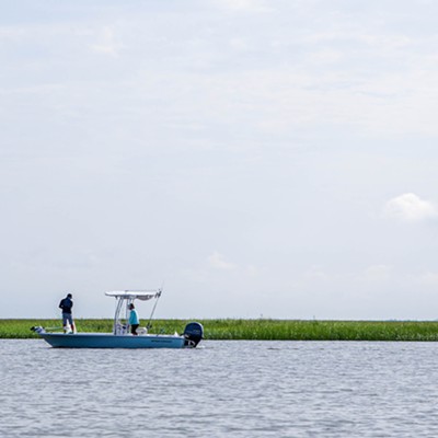
The collection of data for the topographical survey is painstaking. To get accurate readings of elevation and depth in the marsh terrain, where some areas are firm enough to walk and others can only be accessed by boat, Robinson will spend the rest of the year toting around an instrument known as a Real Time Kinetic Global Positioning System (RTK GPS).
“He goes out and sets the rod down right at the marsh surface and collects a data point there. Then he goes 5 meters more and does another data point,” Alexander explains.
Walking through the intertidal area and floating through the inundated areas, Robinson has collected over 70,000 points of data since the survey started in February. However, Alexander expects that they will need around one million data points to get a complete picture of the marshes topography.
“We think by the end of the year he’ll be done,” says Alexander.
While a more accurate picture of the marsh’s physical shape will improve the results of Blanton’s testing of the Savannah River Lab’s effluent model, it will also be used by the Los Alamos National Laboratory to test the accuracy of a new, high tech surface mapping instrument.
“We’re providing the validation data set for their instrument,” Alexander says. “This will be their first big test in the real world in these sorts of environments.”
Because it is still being tested, the lab will create a map of the marsh using its new laser mapping system and then compare its results with those collected by Robinson to assess the accuracy.
Developed by the Los Alamos lab, the new mapping tool uses a photon beam shot from a plane and captures data by sensing how long the beam takes to bounce back, similar to sonar, but able to create a three dimensional map of a surface.
The new system improves upon previous technology like LIDAR (Light Detection and Ranging), which detects reflected light. The problem with LIDAR is that it averages elevation across its footprint, and can have trouble getting accurate readings through trees and particularly with things like marsh grass. The new system takes a reading with a beam that is only as wide as a photon, making it able to pass through the grasses and other vegetation.
With the addition of more accurate topographical mapping, Blanton, with support from the Department of Energy, is preparing to repeat the dye study attempted in 2007 in order to re–test the circulation model developed by the Savannah River Lab.
Although the research they are doing now will function solely to validate the new model, Blanton hopes that the results of the study will be able to be used by other organizations, particularly environmental agencies.
“We have an interest that’s a little bit beyond helping the Department of Energy,” he says. “We’re trying to get some conceptual tools that we can hopefully get some of the management agencies to look a little more realistically at the marsh.”
The problem, according to Blanton, is that in many cases, when permits for the dumping of wastewater and other effluents are calculated, they are done so using a simpler circulation model, one that assumes the waste is immediately flushed through the marsh, rather than being trapped for a period of several days.
“These kinds of studies,” says Blanton, “They all point to the fact that you really can’t ignore the effect of the marshes on the circulation or their effect that will retain any kind of pollutants.”

